File:1971MapAnTirClip.jpg
Jump to navigation
Jump to search
Size of this preview: 631 × 599 pixels. Other resolution: 953 × 905 pixels.
Original file (953 × 905 pixels, file size: 174 KB, MIME type: image/jpeg)
Summary
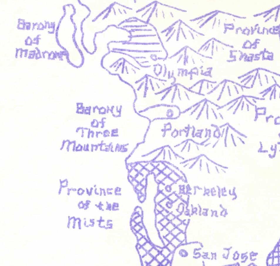
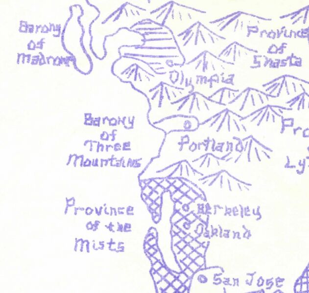
Close up of the An Tir portion of the earliest known map of the Kingdom of the West that includes the baronies of Three Mountains and Madrone in what would become An Tir. From the April 1971 Lydd newsletter.
File history
Click on a date/time to view the file as it appeared at that time.
| Date/Time | Thumbnail | Dimensions | User | Comment | |
|---|---|---|---|---|---|
| current | 07:33, 20 May 2025 | | 953 × 905 (174 KB) | SirRichard (talk | contribs) | Close up of the An Tir portion of the earliest known map of the Kingdom of the West that includes the baronies of Three Mountains and Madrone in what would become An Tir. From the April 1971 Lydd newsletter. |
You cannot overwrite this file.
File usage
The following page uses this file: